Return to front page

Forest Service
Fire Info:

1-866-651-4234 or
307-739-5577

8:00 AM to 8:00 PM
7 days a week during fire season

Continuing News:
Wild Fires
Current information on wild fires near Pinedale, Wyoming, the western Wind River Mountains, the Wyoming Range, and the southern portion of the Bridger-Teton National Forest.

Partial Camp Fire Restrictions
are in effect

BTNF Fire Restrictions

Fire Danger is Moderate
Fire Page sponsored by:
Triple Peak Lodge
Home | NIFC Current Wildfire Map | Bridger-Teton NF Fire Info | Teton Fires

Wild Fire Updates
Sunday, July 21, 2002 -
9:30 pm

Latest News: Rain has helped slow Mule fire, 50% contained
The Mule Fire was helped Saturday by shower activity from passing thunderstorms, which was locally heavy at times, giving crews more of a chance to get a handle on spot fires on the northeast side on Sunday. Spot activity on the northeast side of the fire remains the main target. Fire fighter and public safety are the main priorities. The fire is 50% contained and 3,585 acres. Resources currently on the Mule Fire are twelve 20-person hand crews (from many places), four ten-person camp crews, three helicopters, four dozers, fourteen wildland engines and a Type II National Incident Management Team from North Carolina. (National Fire Situation Report)
Bridger-Teton National Forest fire press releases

  • The area closure remains in effect for the Horse Creek/Beaver Creek drainage areas in the path of the fire. The road is closed to traffic, except locals and fire fighters, at the Merna Junction. The public is asked to refrain from going to this area unless necessary. Be aware of increased traffic on the roads due to fire fighting activity. Also, there is increased air traffic all through this area with helicopters and fixed wing planes due to the area fire activity.

  • Fire information hotlines: Toll free, 1-866-651-4234 or 307-739-5577. Fire Information Officers will staff phone lines from 8:00 AM to 8:00 PM, seven days a week or as needed for current fire activity.
  • Other fires are currently burning in Yellowstone National Park and Grand Teton National Park. See the Teton Fires web site for more information on these fires, www.tetonfires.com.
  • Fire restrictions are also in effect on BLM, State lands and Sublette County. No fireworks are allowed at any time on any of these lands. Camp fires are allowed ONLY in developed campgrounds. Please make sure your fire is completely out before leaving your campsite.
  • Geomac Fire Map web site

  • Wyoming BLM Fire Page

  • See the Bridger-Teton National Forest fire press releases for more BTNF fire info.
Looking north at the Mule Fire and Horse Creek drainages from Ryegrass Road.. This picture was taken yesterday, Saturday. Note the heavy cloud cover which brought a lot of rain at times.

Much better year for grass! Some ranchers got part of their fields hayed before the rain started.

The two pictures above were taken Saturday near the Merna Junction. The left picture shows how much better our grass crop is this year than recent years. The grass is past the 3rd wire on the fences in many places. The Wind River Mountains are in the background to the east. The right photo was taken from the Ryegrass/Merna cutoff road and shows Merna Butte to the left and the fire area in Horse Creek and Beaver drainages in the Wyoming Range mountains just to the right. Minimal smoke was coming from the fire yesterday. Some area ranchers have started to hay their fields, but stopped due to the rain over the past couple of days. Click on the pictures for a larger view. Photos by Pinedale Online.

Mule Fire Photos

Mule Fire road block at the Merna Junction. Photo by Pinedale Online.
Click for larger view

Above shows the Sheriff's road block at Merna Junction Saturday. Road behind leads to Horse Creek. Merna Butte is on the left. Only fire fighters and local residents are allowed beyond the block. Note the cloud cover which brought heavy rains at times. The fire is in the forested area just to the right of this photo.


Click for larger view

Mule IC fire camp on Ryegrass Cottonwood road. The fire is north, to the right, in this photo taken Saturday afternoon. Mt McDougal of the Wyoming Range is in the background further west in this photo. Locally heavy rains have helped dampen the fire but also turned the road into a slick and muddy mess that makes even getting to the fire difficult at times. Footing on the ground at the fire has been hazardous for ground crews due to the rain. Photos by Pinedale Online.

Local Fires at a Glance

Mule Fire:
Horse Creek, Big Piney Ranger District
Size: 3,585 acres
Status: 50% Contained
Cause: Lightning


More Current Fire Information:
Cloudy weather and numerous small cells of thunderstorms producing sometimes very heavy rain helped fire fighters in their activities by dampening the momentum of the fire. It also hindered somewhat by making roads a muddy mess and creating slippery conditions on the ground for hand crews. Minimal smoke was visible today from the fire area. By afternoon, the fire is called 50% contained. Crews are still attacking hot spots and actively concentrating on the spot fires on the northeastern edge of the fire. Safety is a primary concern on this fire. Crews are hoping to take advantage of the wetter conditions which have slowed the fire movement to get a handle on the spots to the northeast which are the most dangerous if things dry out and the fire gets going again. Homes are located to the east on Beaver Ridge and in the Beaver Valley, as well as in the Hoback Rances area to the north. No structures are currently threatened by this fire.
    The primary concern now is for fire fighter and public safety. Crews are only working during daylight hours due to the extreme danger from falling snags. One fire fighter has already been killed this year in the US from a falling snag. Slippery conditions from the recent rain also is making footing treacherous. Access to the fire is now also a challenge due to slippery, muddy dirt roads. The local roads have never been so well marked with each blind corner posted with a makeshift warning & speed sign, badger holes marked with bright orange flagging tape, and culvert crossings marked with stakes and bright orange flagging ribbon. All this is essential with so many new people in the area who aren't familiar with our rural roads and who don't know the location of the local 'hazards' we dodge on a regular basis driving the roads. Locals know how slick the sections of dirt road in the red clay can get when wet.
    This is a good time in our report to once again thank all the dedicated fire fighters who travel from place to place helping put out wild fires and living in tent camps with minimal conveniences. To the families of the fire fighters who may be reading this, they are doing a fantastic job, and so far no serious injuries. The area they are working in has great elk and deer hunting, and in the winter it is one of our premier snowmobiling areas. The David Ranch, located just a couple of miles to the east, is a working cattle ranch that brings guests in for cattle drive vacations and a real cowboy experience. In the summer, the cattle they work for local ranchers (ie. Barney Ranch) are pastured in the forest where this fire is burning. According to Melvin David, so far their operations have not been affected by the fire, but they are watching it very closely. There are also several very nice rural subdivisions within just a few miles of this fire. Beaver Ridge has many nice homes and Aspen Ridge is a new subdivision. Hoback Ranches homes are to the north just over the ridge in the Hoback drainage. The Forest Service is posting several updates a day about the status of this fire, and others on the BT-NF, and these are a great way to keep up to date on what is going on with fires in our area:
Bridger-Teton National Forest fire press releases
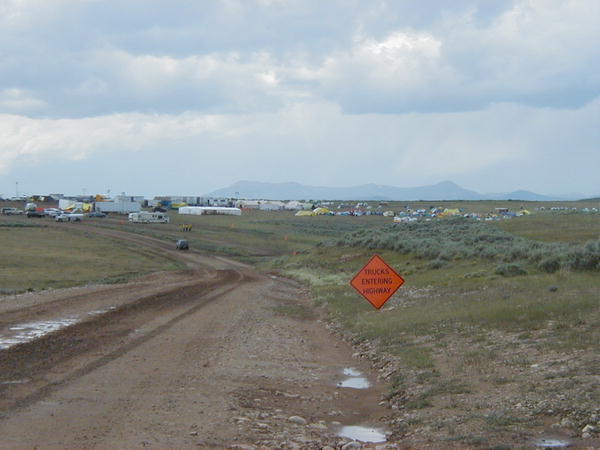
   Resources currently working the Mule Fire include twelve 20-person hand crews, four ten-person camp crews, three helicopters, four dozers, fourteen wildland engines and a type II National
Incident Management Team. All large airtankers remain grounded in response to Thursday's air tanker crash near Denver, Colorado which killed the two crew members on board.
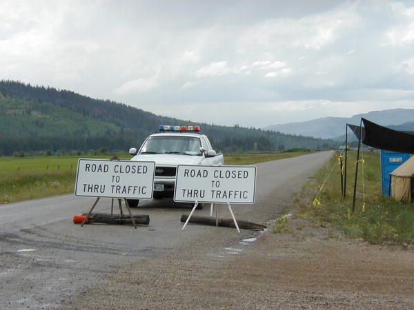
    The road block at the Merna Junction remains in effect with Sublette County Sheriff's Officers manning the block. Only fire fighting personnel and local residents are being allowed through. The block also applies to the road leading to Beaver Ridge and Beaver drainage which takes off to the north at this same junction. The area closure for North and South Beaver, Dry Beaver, Lead and Horse Creek drainages and all associated access routes remains in effect. This special closure was implemented to preserve firefighter and public safety and will be reviewed daily for 
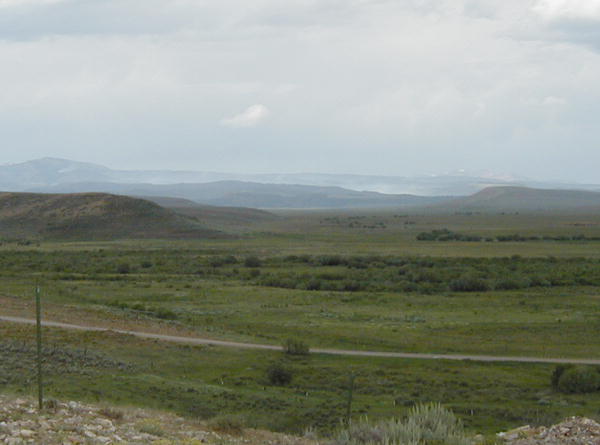
applicability. The Mule Fire is located approximately 20 miles west of Daniel with its eastern edge six miles west of the Sherman Guard Station. It is one mile north of Prospect Peak and approximately one mile south of Horse Mountain on the Big Piney Ranger District. The fire base is located on the Cottonwood/Ryegrass road. Fire Perimeter Map
 
  Fire restrictions are now in effect on the Bridger-Teton National Forest and in Grand Teton National Park. The fire danger is Very High. Daily Forest Service press release updates for this fire are available from the Bridger-Teton National Forest fire page. For more information, contact the Bridger-Teton National Forest at (307) 739-5500 or call the new toll-free information hot line numbers.

Other area fires:
Lightning-caused fires have also sprung up in Yellowstone National Park and Grand Teton National Park. The Teton Fires web site also has interagency fire information links for the Bridger-Teton National Forest, Grand Teton National Park and Yellowstone National Park, www.tetonfires.com. The public is encouraged to report any new smoke columns they see. You can keep up with where the fires are burning by checking in on the National Interagency Fire Center (NIFC) Large Fire update page and Fire Map.

Fire Page Sponsor

Please visit our sponsor's web site. They help make this fire update page possible.

Triple Peak Lodge
Located on South Cottonwood Creek near the Wyoming Range
triplepeak.com

The family that owns and operates Triple Peak Lodge and Triple Peak Outfitters also helps with Pinedale Online and this fire update page, making it possible to bring this frequently updated information each fire season to our readers.

Click for Pinedale, Wyoming Forecast

Mule Fire Perimiter Map

General Mule Fire Area Map (303K PDF)

PDF images require Adobe Acrobat Reader to view. Note that you can zoom in on the PDF to get a closer view and image.


CURRENT FIRE RESTRICTIONS

Bridger-Teton National Forest:
Partial fire restrictions are in effect on the Bridger-Teton National Forest. Back country users are reminded that campfires are not allowed above timberline in the wilderness at any time. Fireworks are prohibited at all times. Restrictions

Sublette County
County-wide fire restrictions are in effect. Lighting fireworks is prohibited within Sublette County.

BLM:
Fire restrictions began July 4th. No open fires except within developed recreation sites. Regulations regarding smoking, operating a chain saw, and welder are in effect. No fireworks.

State:
Restrictions went into effect on State lands on June 11th.
No open fires, barbecue grills or fireworks on any lands or facilities administered by the Game and Fish Department.

Links to earlier Fire Info:
July 19, 2002
July 18, 2002
July 17, 2002
July 16, 2002
July 15, 2002
July 14, 2002
July 13, 2002
July 6, 2002
July 5, 2002
July 4, 2002
July 3, 2002
July 2, 2002
July 1, 2002
June 30, 2002
June 29, 2002
2001 Fire Updates
2000 Fire Updates

For More Info on the Web

Teton Fires
Bridger-Teton National Forest

National Interagency Fire Center NIFC
NIFC Wildland Fire Map

Where to get more information:
Bridger-Teton NF Fire Info
Mary Lendman or Jason Anderson
307-739-5542 or 307-739-5564

Pinedale Ranger District, BTNF
307-367-4326

Big Piney Ranger District, BTNF
307-276-3375

Where to report fires:
Sublette County Sheriff's Office

911 or 307-367-4378
Pinedale Ranger District
307-367-4326
Big Piney Ranger District
307-276-3375
BTNF Supervisor's Office (Jackson)

307-739-5500
Teton Fire Dispatch
(Grand Teton Park in Moose)

307-739-3630
307-739-3300

Callers are reminded that if they are using a cell phone, they may not get a local office when they dial 911. The best place to call for area fires is either the local Sheriff's office or the Bridger-Teton Fire Office. Be prepared to give a location of the smoke, your name, where you are calling from, and how they can get ahold of you again for more information if needed.


Anyone with concerns about fires can contact the Sublette County Sheriff's office at 307-367-4376, or the Pinedale Ranger District, 307-367-4326. Hikers in the wilderness who have cell phones (and can get a signal out) can call 911 and ask to be routed to the Sublette County Sheriff's office if they need to report a fire or have concerns. Be aware that 911 may route you to a different area other than Pinedale depending on where you are calling from.


Return to Pinedale Online front page

This Pinedale Online fire update is written by Dawn Svalberg from information obtained from the Pinedale Ranger District, the Jackson office of the US Forest Service Bridger-Teton National Forest, and online sources. Pinedale Online is solely responsible for the content of these reports. Copyright 2002.

Pinedale Online!
Located in Office Outlet, PO Box 662, Pinedale, WY 82941
support@pinedaleonline.com
307-367-6763

www.pinedaleonline.com