|
www.PinedaleOnline.com www.Pinedale.com |
Pinedale
on the Web! |
| Pinedale Online > News > July 2012 > Fontenelle Fire update – Saturday, July 7, 2012 > Fire July 4 - NASA satellite view |
Back to Article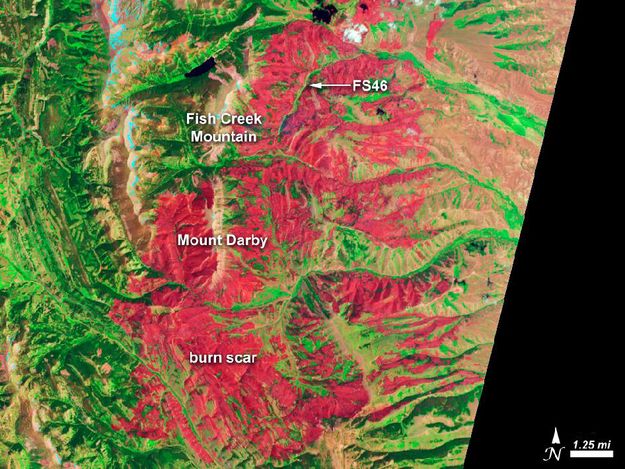 © Photo by National Aeronautics and Space Administration (NASA) |
|
The Advanced Land Imager (ALI) on the Earth Observing-1 (EO-1) satellite acquired this image of the affected area on July 4, 2012, when the fire was 16 percent contained. Burned forests appear red in this false-color image; unburned forests are green. The blue patches along the brown ridges on Fish Creek mountain and the highlands to the west are snow. |
|
Copyright © 2012 Pinedale Online. All rights reserved. |