Pinedale Online!
www.PinedaleOnline.com
www.Pinedale.com

Pinedale on the Web!
Pinedale, Wyoming

Home | Calendar of Events | Photo Gallery | Local Businesses |

Pinedale Online > News > December 2009 > Road, Weather and Travel Links

Laramie gate. Photo by Wyoming Department of Transportation.
Laramie gate
View of Interstate 80 at Laramie gate on Saturday, December 26. The Interstate is closed due to adverse weather conditions. WYDOT webcam view.

I-80 Summit. Photo by Wyoming Department of Transportation.
I-80 Summit
I-80 Summit on December 26th. WYDOT webcam view.

WYDOT roads. Photo by Wyoming Department of Transportation.
WYDOT roads
Wyoming travel info on December 26, 2009. WYDOT travel graphic.
Road, Weather and Travel Links
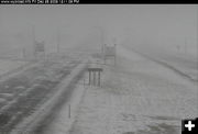
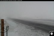
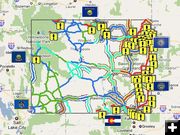
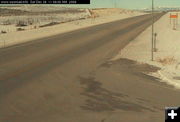
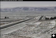
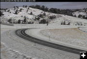
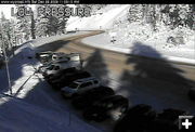
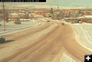
Road closures on eastern side of Wyoming due to adverse weather
by Pinedale Online!
December 26, 2009

Adverse weather conditions on the eastern side of Wyoming have caused authorities to close a number of the major interstates the day after Christmas, disrupting normal and holiday travelers trying to get where they are trying to go. Interstate 80 (I-80) is closed for most of the eastern half of the state.

Road information is available by calling 1-888-996-7623 nationwide. In Wyoming, dial 5-1-1.

Below are links to useful website for travel and weather information for Wyoming. Helpful hint: Do a Shift or CRTL-Refresh in your browser when viewing these pages to make sure you are seeing the most current updated version of that page and not a cached version on your hard drive.

Road travel condition map Very helpful graphic maps showing road closure status in Wyoming. You can choose your bandwidth for viewing and download speed.

Road webcams Wyoming Department of Transportation has webcams placed at strategic locations on major roadways to show current conditions on those roads.

Road Closures and Advisories WYDOT current road closure info

WYDOT road info Text info for current Wyoming road conditions

Pinedale area travel and weather info Pinedale Online travel info page

Pinedale/Upper Green River Valley area webcams

Southwest Wyoming road info WYDOT road info for Pinedale/western Wyoming roads

Wyoming Weather info National Weather Service map. Click on area of interest to get local weather forecast for that area.


US191 Pinedale. Photo by Wyoming Department of Transportation.
US191 Pinedale
US 191 between Pinedale and Daniel Junction on Saturday, December 26th. Roads are good in the Pinedale area. WYDOT webcam view.

South Pass - West. Photo by Wyoming Department of Transportation.
South Pass - West
South Pass, WYO 28, view looking west on Dec. 26th. WYDOT webcam view.

South Pass. Photo by Wyoming Department of Transportation.
South Pass
WYO 28, South Pass, view looking east on Saturday, December 26th. WYDOT webcam view.

Teton Pass. Photo by Wyoming Department of Transportation.
Teton Pass
View of Teton Pass, WYO 22, on Saturday, December 26. WYDOT webcam view.

Lander. Photo by Wyoming Department of Transportation.
Lander
View of US 287 in Lander on Saturday, Dec. 26. WYDOT webcam view.

I-25 Whitaker. Photo by Pinedale Online.
I-25 Whitaker
Interstate 25 at Whitaker, between Chugwater and Cheyenne, on Saturday, Dec. 26. This interstate is closed at the time of this photo. WYDOT webcam view.
Pinedale Online > News > December 2009 > Road, Weather and Travel Links

Pinedale Online!
Pinedale Online! PO Box 2250, Pinedale, WY 82941
Phone: (307) 360-7689 or (307) 276-5699, Fax: (307) 276-5414

Office Outlet in Pinedale, 43 S. Sublette
E-mail:support@pinedaleonline.com

Copyright © 2009 Pinedale Online. All rights reserved.
Pictures and content cannot be used in whole or part without permission.