![]()
Fire
Update
July 5, 2001 2
pm
|
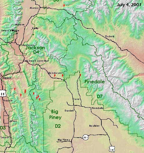
Fires
At a Glance
|
|
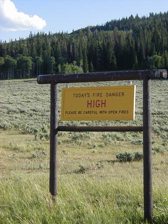
FIRE
DANGER is: HIGH
|
For
More Info
|
|
Bridger-Teton
National Forest |
Where
to report fires:
Sublette County Sheriff's Office
911 or 307-367-4378
Pinedale Ranger District
307-367-4326
Big Piney Ranger District
307-276-3375
BTNF Supervisor's Office (Jackson)
307-739-3300