![]()
| Aerial
Photos Of the Pinedale, Wyoming area (Pictures taken during May, 1999 flight)
|
Mountain and lakes around Pinedale
|
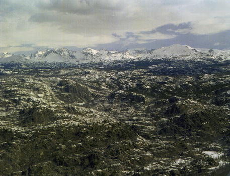
Wind River Skyline, looking east from above Boulder Lake. Fremont Peak on left side of picture. |
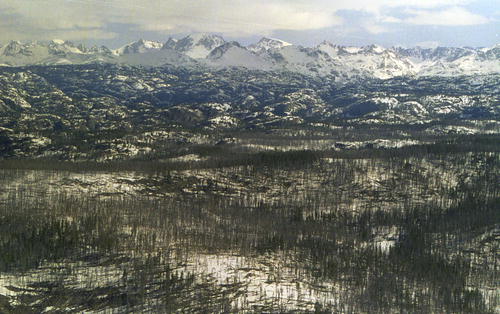
Wind River Skyline, looking east from above Boulder Lake. Fremont Peak just left of center. These two pictures don't capture how incredibly rugged the terrain in the foreground is. |
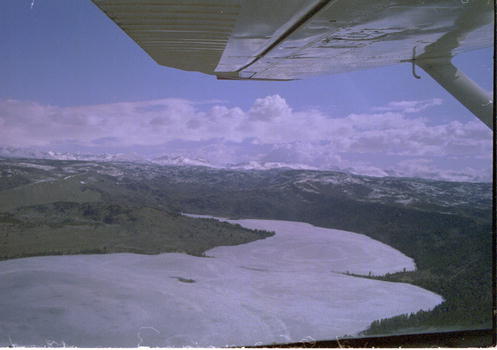
Looking east at Upper end of frozen over Willow Lake with Wind River Mountains in backroung. |
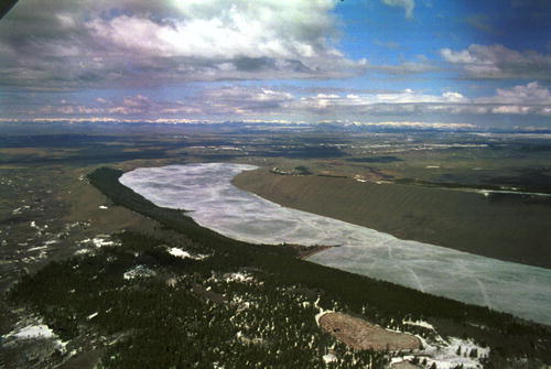
Looking west at lower end of frozen over Willow Lake. Wyoming Mountain range in far distance. |
|
Looking east at outlet of Boulder Lake |
Looking west at lower end of Boulder Lake |
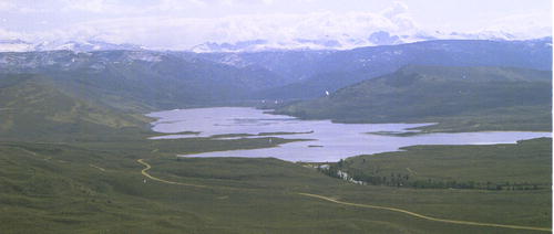
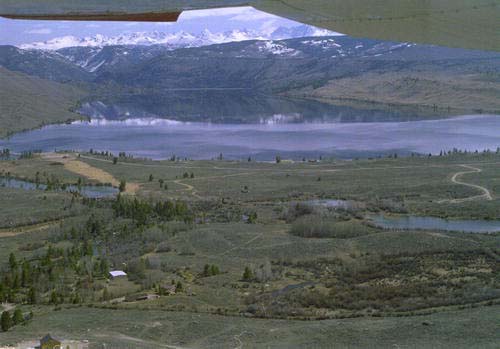
Looking east at upper end of Boulder Lake. Wind River Mountains in background. |
Looking north at upper end of Boulder Lake and summer home community. |
|
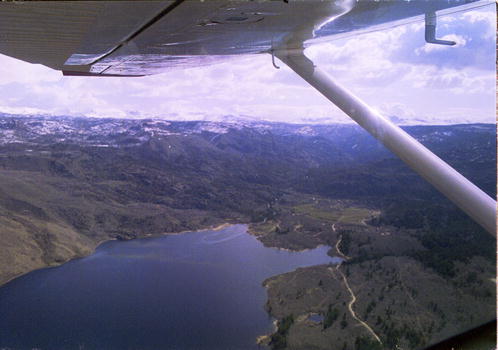
Steward Flat/outlet of Fremont Lake (site of 1999 archaeological dig). Looking east with Wind River Mountains in background. |
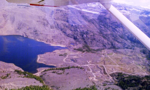
Looking east at Stewart Flat/outlet of Fremont Lake. Road is access for new waterline pipe. |
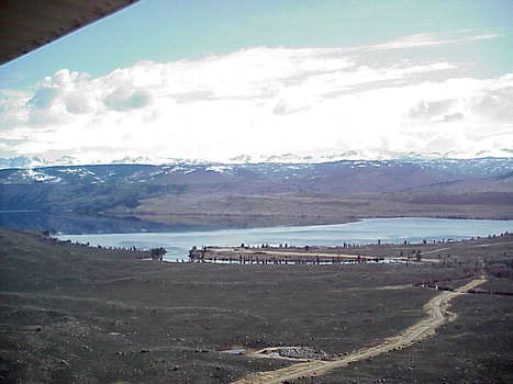
Looking east at lower end of Fremont Lake, Skyline Drive and the Wind River Mountains |
Looking east flying above the Soda Lake Road. Stream is Pine Creek flowing out of Fremont Lake in background. |
|
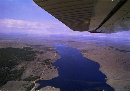
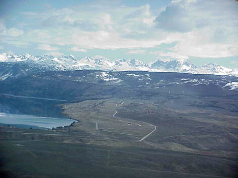
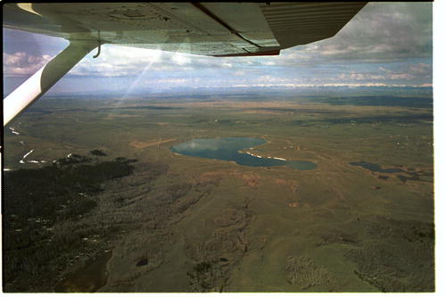
View looking west at Soda Lake. Fremont Lake is just to the left out of view. |
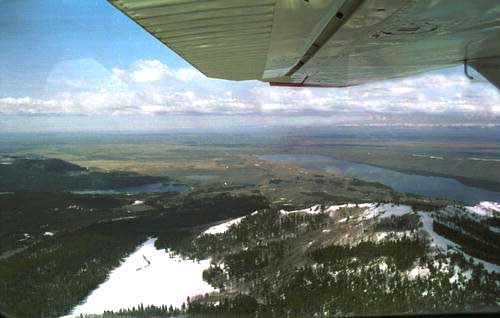
View looking west shows Half Moon Lake on the left and Fremont Lake on the right in middle of picture. Foreground shows the back side of the White Pine Ski area. |
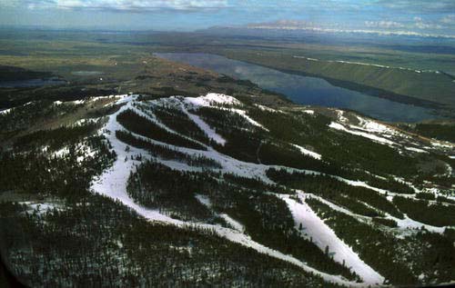
View looking west with White Pine ski area in foreground and Fremont Lake in back. What a gorgeous view for skiers! 1999 will be the first season open in many years. |
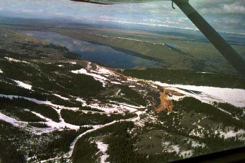
Looking more northwest at White Pine Ski area and Fremont Lake. Ski area and road still under construction. |
Closeup Views of Town of Pinedale
|
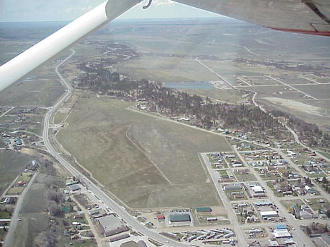
View looking west at part of town south of Hwy 191 and east of Pine Creek. Road that bends to left and goes up the hill in the background is the Fremont Lake Road. |
View looking south at Redstone and town west of Pine Creek |
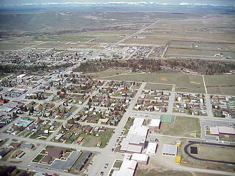
View looking at east Pinedale on the north side of Hwy 191. |
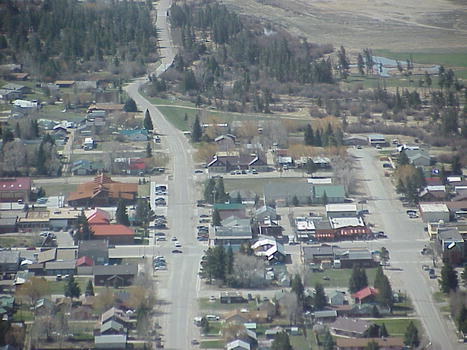
View looking south down Tyler Avenue. |
|
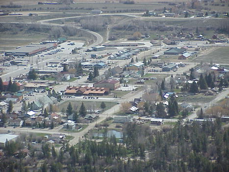
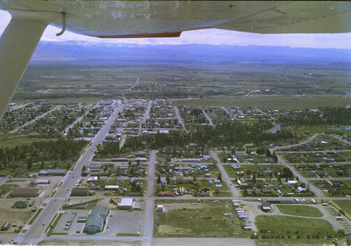
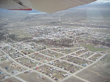
View looking west at Pinedale north of Hwy 191. School building complex in lower right foreground. Hwy 191 towards Jackson goes off to west in background. Tree-lined Pine Creek crosses middle of picture. |
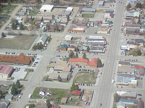
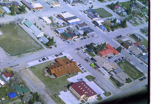
Close-up view of Hwy 191 and buildings in center of Pinedale. The County Courthouse and Library are in center of picture with red roofs. |
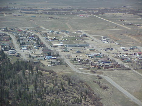
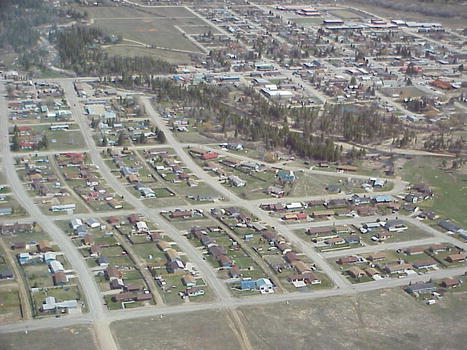
View looking north at Redstone neighborhoods flying along southern end of town. |
View looking south across Pinedale flying along northern end of town. Tyler Avenue goes from top to bottom in middle of picture. |
View looking at east end of Pinedale and Hwy 191 as it rounds bend on east side of town and goes towards Rock Springs. Tree-lined Pine Creek in middle of picture. In background can see where New Fork River joins with Pine Creek. |
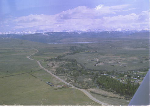
View looking northeast across Pinedale flying along the southern end of town just above Redstone. Fremont Lake can just barely be seen at plane wingtip. |
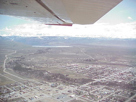
View looking northeast across Pinedale flying along southwest side of town. Fremont Lake in background. |
View looking south at Redstone housing area on west side of town and Pine Creek. |
|
View looking almost due east along Hwy 191 from west side of town. Best Western Pinedale Inn in foreground. |
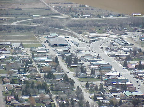
Closeup view of the Pinedale Library, Fire Hall, and County Courthouse blocks. |
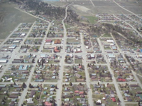
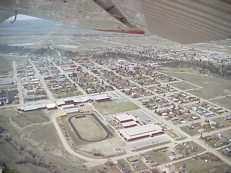
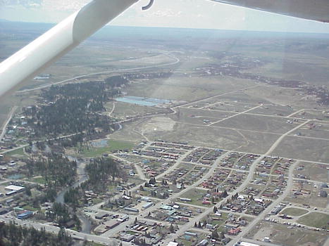
View flying along Orcutt Hill looking south at the north side of town. Elementary School and track in foreground. |
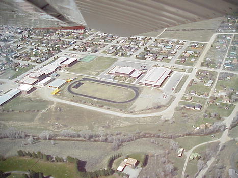
View flying along east end of town looking west with closeup of the school block complex and track. |
Historic Green River Rendezvous Grounds
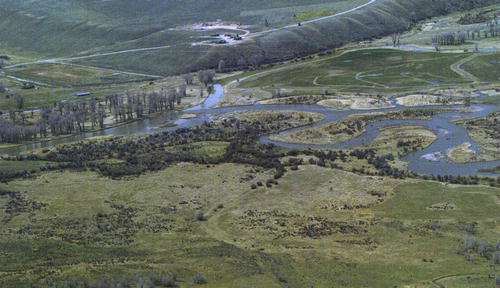
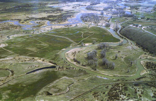
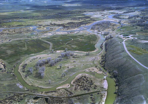
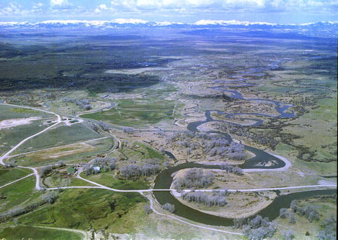
Confluence of Green River & Horse Creek, DeSmet Monument
|
View looking west at confluence of Green River and Horse Creek. DeSmet Monument and Daniel Cementary on hill in background. Site of historic Green River Rendezvous. Green River flows to the left. |
View looking southeast at confluence of Green River and Horse Creek. DeSmet Monument and Daniel Cementary on hill on right. Site of historic Green River Rendezvous. Green River flows south off top of picture. |
View looking west at confluence of Green River and Horse Creek. DeSmet Monument and Daniel Cementary on hill on right. Site of historic Green River Rendezvous. |
View looking northwest up Green River just below confluence with Horse Creek. DeSmet Monument and Daniel Cemetery are on hill on the left. Daniel is in the background. Wyoming Range in far back. |
Views of Approach to Pinedale Airport, Wenz Field
|
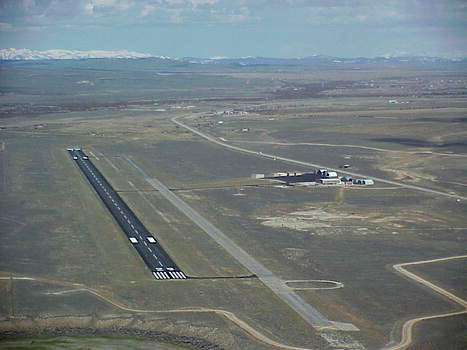
View looking north at Pinedale Wenz Field airport. Hwy. 191 is behind airport buildings in center of screen. |
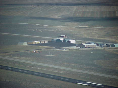
View looking northeast across runway at airport buildings. Highway 191 goes north off left side of picture behind airport buildings. |
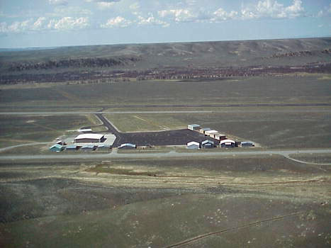
View looking west with Hwy 191 and airport buildings in foreground and airport runway in middle of screen. New Fork River and the Mesa are in the background. |
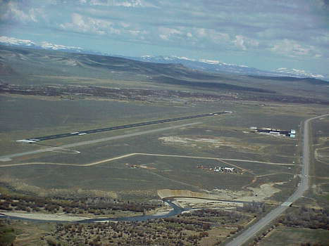
View looking north at airport. Highway 191 going north is on the right side of picture. New Fork river running south is in the background and top left. Pole Creek crosses Hwy 191 and flows to left at south end of runway. |
| Copyright 1999. May not be reproduced without permission. Many thanks
to Allan Kinnison for the excellent piloting skills. Some of the photos
above were taken with a digital camera and others with a 35 mm.
Area
Attractions | Outdoor Recreation | Events
Calendar | Newcomer's Info | Businesses Where am I? Pinedale Online! Front Page=>Photo Gallery=>Aerial Photos Take me to the Site Map. |