 |
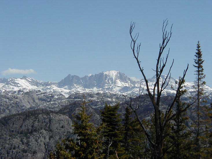
Wind
River Mountains
|
|
Wind
River Mountains
|
Wind
River Mountains
|
Wind River Mountains At-a-Glance Size: 2.25
million acres |
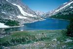
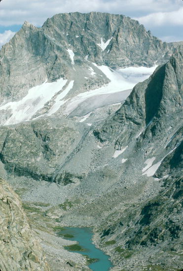
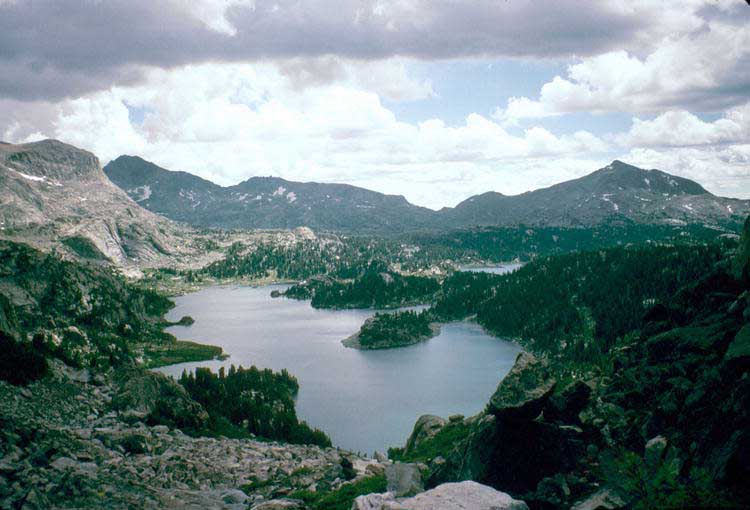
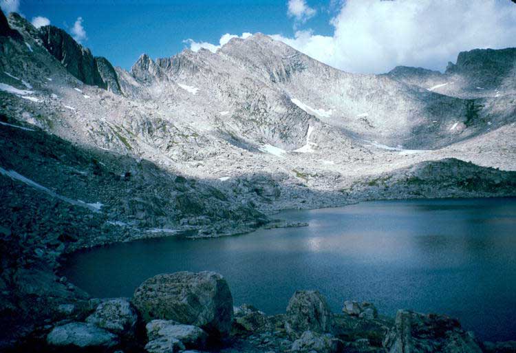
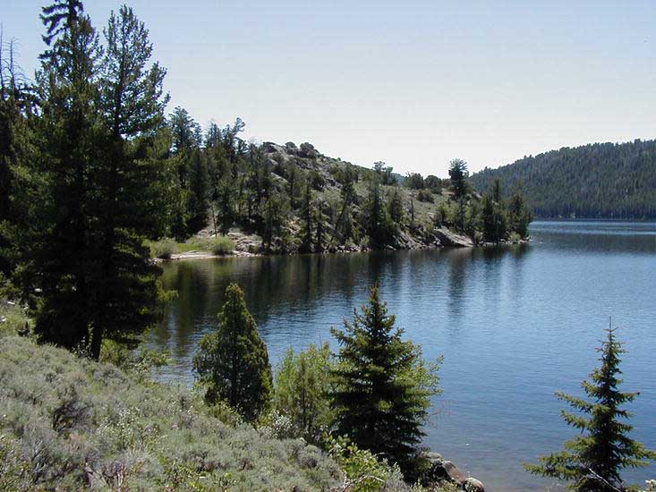
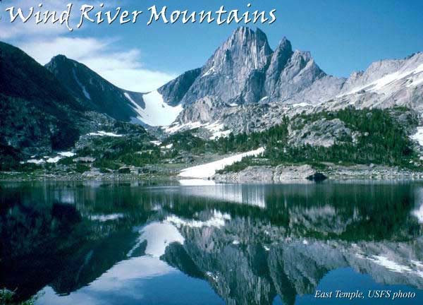
The 90-mile long Wind River Mountain range form the Continental Divide of the Rocky Mountains in western Wyoming. These rugged and scenic mountains contain four wilderness areas and over 2,900 lakes and ponds. Wyoming’s highest mountain, Gannett Peak, is in this mountain range. Favorite destinations include Gannett Peak, Cirque of the Towers, Green River Lakes, Square Top Mountain and Photographer's Point.
The crest of the Continental Divide is composed of towering mountains from 12,000-13,000 feet high, with over 35 named peaks over 13,000 feet that attract climbers and backpackers from around the world. The Continental Divide National Scenic Trail traverses the Wind River Mountains.
These mountains are home to grizzly and black bear, elk, moose, deer, wolves and many other wildlife species. This is the headwaters for the Snake, Missouri and Colorado River drainages.
Lakes and streams contain rainbow, cutthroat, golden and brook trout. Grayling and mackinaw can also be found in some places. Fishermen need to have a valid Wyoming fishing license. Current licenses and regulations are available in Pinedale.
Activities
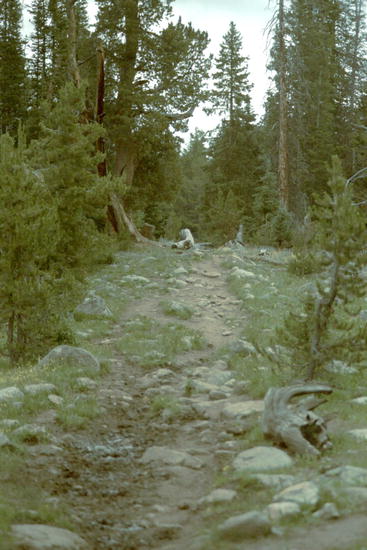
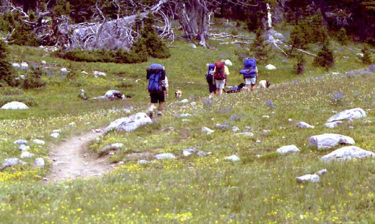
Hiking & Backpacking
Camping
Wilderness
Pack Trips
Wilderness
Fishing
Rock
Climbing
Mountain
Climbing
Hiking & Backcountry
Recreation
The high Wind River Mountains typically don’t free up from snow until
around mid-July. “Summer” in the high country is about 3 months
long, usually lasting until mid-September before snows return. That being said,
it can snow ANY day of the year in the mountains given the right weather conditions.
Backcountry visitors should come prepared for a variety of weather conditions
for warm days and possible very cold nights. Good footwear, warm clothing to
layer, sunscreen and bug repellant are mainstays for the supply list.
Much of the high country terrain is above tree level, hikers should also bring self-contained portable stoves and fuel supply. Water purification tablets or filters are also a must to avoid ingesting harmful microorganisms from surface water sources. The water may look clean, but do not drink from lakes or streams without first purifying the water. Mosquitoes and biting bugs are at their worst during July and August. By late August and September the bugs generally aren’t so prolific.
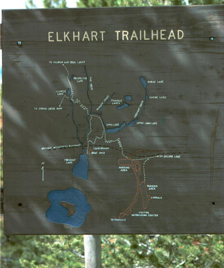
There are many good guidebooks and maps for the Wind River Mountains available at bookstores or to order online. There are also many web pages by people who have done hikes into the Winds that can be found using search engine searches on terms like “hiking Wind River Mountains”.
Wilderness
Areas
Four
designated wilderness areas are located within the Wind River Mountains.
Three are managed by the U.S. Forest Service from two National
Forests, the fourth is managed by the Shoshone and Arapho Tribes
from the Wind River Indian Reservation.
Note that there are no roads in designated wilderness areas. Mechanized vehicles, including snowmobiles and mountain bikes, are not allowed in the wilderness, but are allowed outside those boundaries.
Popular areas of these wilderness areas get a lot of visitors during the peak summer months, so expect company and some competition for campsites in some areas. With millions of acres in which to play, there are many places to go to get away from it all and be alone.
All users should be aware that in the wilderness setting, help can sometimes be days away should misfortune or emergencies arise. Cell phones often do not have reception in many remote areas, so visitors should come prepared to take care of medical emergencies and subsist without help for days.
Special regulations apply to wilderness areas, so be sure to check with the managing entity for rules for the area you plan to visit. Organized groups typically require a free permit, and there is a day stay limit for camping to avoid overuse of areas.
Not all trails are maintained in the backcountry and some trails are not recommended for pack stock. Be sure to bring good maps, compass and research the area you plan to visit so you are aware of what you can expect to encounter when there. Be alert for signs of hypothermia and altitude sickness.
Wind
River Range Wilderness Areas:
Bridger
Wilderness ( Bridger-Teton National Forest)
Popo Agie Wilderness ( Shoshone National Forest)
Fitzpatrick
Wilderness ( Shoshone National Forest) | Wind
River Roadless Area ( Wind River Indian Reservation)
Continental
Divide National Scenic Trail
Approximately
80 miles of the Continental Divide National Scenic Trail (CDT)
runs through Wyoming. This scenic trail goes from Mexico to
Canada. In Wyoming, it goes from the Sierra Madre mountains
to the western edge of Yellowstone National Park along the Continental
Divide. The trail passes through the Big Sandy Opening in the southern
part of the Winds to Green River Lakes on the northern end of the range.
The trail is marked with CDT signs, wooden signs, tree blazes or rock
cairns. In some places, the trail is obscure, so it is helpful to have
good maps and a compass with you. This is a very scenic segment of
the CDT, making this hike a memorable one that will last a lifetime.
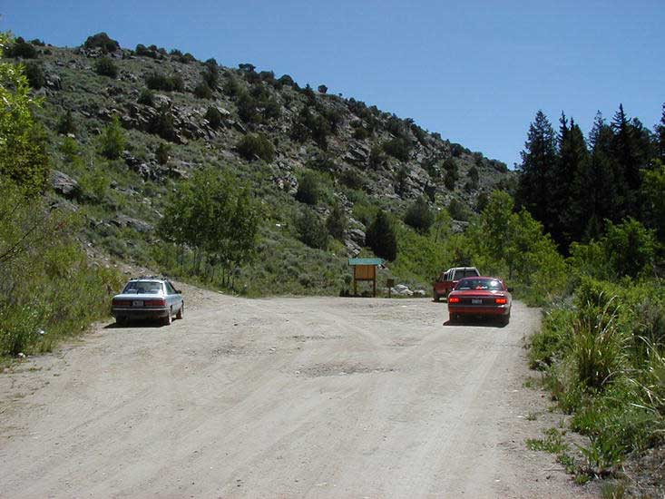
Commercial Service
Local outfitters and guides are available who offer their expertise
about the land and equipment for backcountry excursions. Commercial service
providers must be permitted to operate in wilderness areas and on National
Forest land. Visitors are encouraged to make sure any guide service they
hire is properly permitted by the managing agency. Hunting outfitter
camps operate out of assigned areas and many have their own camps set
up with tents, hitch rails and corrals in specific locations.
Guide services are available for wilderness hiking, horseback pack trips,
spot packs, drop camps, gear drops, photography excursions, backcountry
fishing trips and llama adventures.
For more area information:
Bridger Wilderness
Bridger-Teton National Forest
Pinedale Ranger District
29 E Fremont Lake Road
PO Box 220
Pinedale, WY 82941
Phone: 307-367-4326
Popo Agie
Wilderness
Shoshone
National Forest
Washakie Ranger District
600 North Highway 287
Lander, WY 82520
Phone: 307-332-5460 or 332-9071
Fitzpatrick
Wilderness
Shoshone National Forest
209 East Ramshorn
PO Box 186
Dubois, WY 82513
307-455-2466
Shoshone
& Arapaho Tribes
Fish and Game Department
PO Box 217
Fort Washakie, WY 82514
307-332-7207
Sublette
County Chamber of Commerce
Sublette Visitor Center
PO Box 176
Pinedale, WY 82941
307-367-2242
www.sublettechamber.com
Local
Services & Info |
2.25 million acres, 4 wilderness areas, 2900 lakes & ponds, 48 summits higher than 12,500 feet, hundreds of miles of hiking trails
Scenic
Photos |
| To
contact Pinedale Online, call 307-367-6399, e-mail: support@pinedaleonline.com,
or stop by our office located in Office Outlet in Pinedale, 43 S. Sublette Ave.
Copyright 2005, all rights reserved. Photos by the Pinedale Ranger District as
credited. Other photos by Pinedale
Online. May not be used without permission. | |