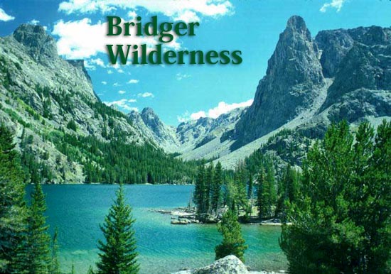
Bridger
Wilderness
Bridger-Teton National Forest,
Wind River Mountains
About the Bridger Wilderness
Wilderness and You
Required Registration & Permits
Wilderness Regulations
Wilderness Safety
Allowed Uses
About the
Bridger Wilderness
The 428,169-acre Bridger Wilderness is located along the Continental
Divide on the west slope of the Wind River Range in Wyoming. It was designated
a Primitive Area under Department of Agriculture Regulations in 1931,
and later made part of the National Wilderness Preservation System with
passage of the Wilderness Act in 1964. In 1984, its original 392,169
acres were increased by 36,000 acres when the Wyoming Wilderness Act
was signed into law. The Bridger Wilderness is administered by the Pinedale
Ranger District of the Bridger-Teton National Forest.
Motorized
vehicles and mechanized equipment, including snowmobiles, bicycles,
hang gliders and chainsaws, are prohibited within the Bridger Wilderness. Wilderness, as defined by the Wilderness Act of 1964, is an area of
undeveloped federally owned land, designated by Congress, that has the
following characteristics:
- It is affected primarily by the forces of nature, where man is a
visitor who does not remain. It may contain ecological, geological
or other features of scientific, educational, scenic or historic value.
- It possesses outstanding opportunities for solitude and a primitive
or unconfined type of recreation.
- It is an area large enough so that continued use will not change
its unspoiled, natural condition.
- It provides the opportunity for (and often requires) self-reliance
and challenge.
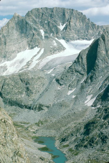
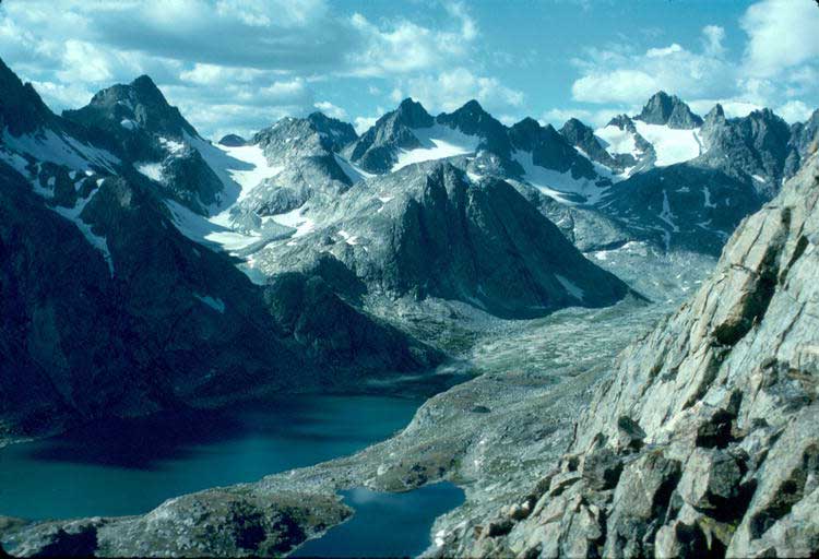
Topography
The intricately faulted Wind River Range is dominated by an
igneous and metamorphic core. Enormous
compressional forces in the earth thrust the block of granite into the
air. The glaciation and erosion that followed carved the range, leaving
13,804 foot Gannet Peak the highest mountain in the Wilderness and in
Wyoming.
Glacial action left
cirques, kettles, U-shaped valleys, hanging troughs, 1,300 lakes, and
left "erratics", boulders strewn about the
lowlands. The sedimentary rocks that once overlay the granitic core of
the range have been stripped from the mountains by erosion. Remnants
of the sedimentary rocks remain near Green River Lakes.
The Wind River Mountain Range has seven of the ten largest glaciers
remaining in the contiguous United States. The Green River originates
in the Bridger Wilderness. The Green River joins the Colorado after 1,500
miles and empties into the Gulf of California. The Green River drains
most of the west side of the Wind River Range. The Sweetwater River drains
the southern end of the range and flows into the Platte River and ultimately
the Gulf of Mexico.
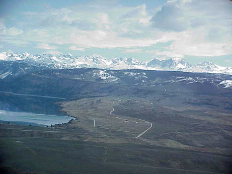
Access
US Highway 191, the major highway between Rock Springs and
Jackson, Wyoming, lies west of the Wind River Range. Trailheads are reached
via roads which are clearly signed at intersections with Highway 191.
Both Jackson and Rock Springs have commercial air and bus lines. Pinedale
has a paved, non-commercial public airstrip located about 6 miles south
of town. Shuttle services between Jackson and Rock Springs, and trailheads,
are available from local private businesses.
Trails
There are over 600 miles of trails in the Bridger Wilderness.
Most well-used trails are cleared early in the season, but fallen trees
may be encountered on secondary trails. Winter snows generally do not
leave the high passes and highest trails until mid-July. Stream flows
are high and swift during snowmelt runoff in June and July, and some
stream crossings can be hazardous. Check at the Pinedale Ranger Station
Office, or call them at 307-367-4326, before beginning your Wilderness
trip. Books with detailed trail descriptions are available at local sporting
good stores and bookstores.
Weather
The weather is usually warm and sunny during the day from
June through September, with afternoon thunderstorms being common. Night
temperatures may be as low as 25 degrees Fahrenheit. Sudden rain and
occasional snow flurries may occur at ANY TIME. During lightning storms
it is best to avoid open areas such as meadows, ridges, lone trees, and
mountain tops. Find safer shelter in dense stands of trees or boulder
fields.
Insects
Mosquitoes, deerflies and horseflies are plentiful most of
the summer, making insect repellent a must.
Wildlife
The Bridger Wilderness contains a rich diversity of wildlife
species, including large mammals such as moose, elk, bighorn sheep, mule
deer, bears (black & grizzly-see Bears and You for
more information), yellowbellied marmots and beaver. Birds that are common
include the Canada ('gray') jay, Clark's Nutcracker and raven. These
birds frequently show up around camp when there is food around. The high
meadows are home to water pipits, rosy finches and mountain blackbirds.
The dipper may be seen in fast-moving mountain streams standing on streamside
rocks, bowing and bobbing, until it decades to plunge into the icy water
for insects. Historically, the Bridger Wilderness had no fish in most
of its lakes. Stocking programs during the 1920's and 1930's were successful,
and today grayling, mountain whitefish and six trout species can be found.
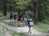
Recreation
Backpacking is the primary activity of people who visit the
Bridger Wilderness, and many trails provide access to the area. There
are also areas without trails for those who wish more solitude. Other
activities include hiking, horseback riding and packing, mountain climbing,
mountaineering, and wilderness camping. Please
note: Motor vehicles, including snowmobiles, bicycles and hang gliders,
are prohibited within the Bridger Wilderness.
Water
The water in the Bridger Wilderness looks clean and pure,
but take care. Waters
throughout the country contain a variety of organisms, some of which
can make you very sick. The parasite Giardia, an organism present as
a cyst in the feces of infected animals and humans, is most commonly
spread through water. Other microbes, including Campylobacter, may also
be around, and can upset your stomach and intestinal tract.
Giardia: If you wish to treat your water for Giardia, boil it
for one minute, or use a filter with a pore size less than one half micron.
Campylobacter: Requires boiling for five minutes or filtering.
Iodine water treatments may work if the directions are followed carefully.
The effectiveness of iodine treatment is dependent on the type of iodine,
freshness, exposure time, and temperature, purity and pH of the water
being treated. Chlorine treatments are not recommended.
Another option for short trips: Bring your water with you.
Maps
Topographic maps, trail maps, Wilderness maps, campground
and recreation facility maps, and other useful guides are available locally
in Pinedale at sporting goods stores. Additional information is also
available at the Pinedale Ranger District and BLM Offices.
Wilderness
and You - Minimum Impact Camping
Camping
Select a campsite away from lakes, streams and other camps to preserve
a feeling of privacy and solitude. Your campsite should be out of sight
of trails and water bodies, or, where screening is not provided by vegetation
or topography, a minimum of 200 feet from lakes or trails. Constant use
of the same campsites leaves permanent scars. Soils become compacted
and plant life is crushed and worn away. Campfire ashes accumulate and
the area becomes visibly worn. If you use an existing campsite, leave
it in better condition than you found it. Or, be a no-trace pioneer and
select an unused campsite away from heavily used areas. Leave it natural!
Select subdued colors for clothing and equipment. Browns and greens are
best. Bright colors have a greater visual impact on the privacy and solitude
of others.
Campfires
Campfires are permitted in the Bridger Wilderness with the exception
of seven "special management areas". Lightweight gas stoves
are more efficient and faster for cooking than fires, and they leave
no impact. Campfires destroy organic matter in the topsoil and may inhibit
plant growth for many years. Blackened rocks, charred wood, and accumulated
ash also alter the natural appearance of the site.
If a campfire is used, here are suggestions to minimize impact:
- A ring of rocks is unnecessary. Instead, dig a firepit about six
inches deep, keep the sod intact and pile it nearby.
- On breaking camp, permit the fire to burn down to white ash and drown
the coals thoroughly. If there is buildup of ash, remove it from the
firepit and scatter it well away from camp, where people won't walk
through it, and the rain and snow will wash it away.
- Replace the sod and pour water on it.
- Scatter any unused firewood in natural appearing locations.
- Keep your fire small to reduce impact and the danger of forest fire.
- Select a spot a safe distance from trees, brush, and down logs,
- Leave no firerings.
Campfires
are allowed below timberline using only down materials. Do not
cut firewood from standing or live trees.
Firewood
Trees grow slowly at high altitude and fires consume wood which would
otherwise decompose and replenish the soil with nutrients. Particularly
in areas where trees are stunted and scarce, gathering firewood has a
severe impact on vegetation. Burn dead and down wood and only that which
is necessary. Standing dead and gnarled snags are components of the wilderness
scenery and important habitat for cavity-nesting birds and many small
mammals.
Sanitation
Bury human waste in a shallow hole at least 100 feet from any water
supply, so that rain or snow runoff will not carry contaminants to lakes
and streams. Studies have shown that decomposition of waste is best in
holes dug 6-8 inches deep. Soap (even biodegradable brands) and food
particles pollute lakes and streams. Please wash your dishes, clothes
and yourself well away from shore. Carry out cans, bottles, plastics,
aluminum foil and anything else that will not burn. Burying doesn't work.
If frost action doesn't heave your buried garbage to the surface, animals
will dig it up.
Please, if you pack it in,
pack it out!
Pets
Pets occasionally bother other visitors, wildlife and grazing livestock.
Please keep your pets under control at all times and away from other
people.
Trail Etiquette
Wilderness trails are constructed and maintained to minimize impact
of human use. Short-cutting switchbacks and cutting across meadows damage
plant life and cause soil erosion. Please use trails where provided.
Hikers meeting horse parties on the trail should move a considerable
distance off the trail and remain quiet and motionless until the horses
pass, unless advised otherwise by the riders. Bright-colored gear, bulky
packs, and sudden noise or movement may cause a horse to spook, resulting
in general chaos, and injury to horses, riders and hikers. Curious pets
can also cause a problem. It is advisable that pets be held until the
horses pass.
Please use the trails where
provided.
Registration & Permits
Registration at the Ranger Station or Campgrounds is not necessary.
Registration boxes are provided at all major trailheads, and visitors
are asked to please register at these stations, and to add your comments
and suggestions. Registers are used as a management tool by the Forest
Service to provide essential information on visitor use and preference.
This information helps Wilderness managers meet the needs of visitors
and minimize impacts to the wild setting.
Permits
Permits are required for the following:
- Organized groups,
- All parties using pack and saddle stock overnight,
- Commercial uses (outfitters and guides).
Group Use
All organized groups (clubs, schools, church groups, scouts, etc.)
are required to obtain a permit from the Pinedale Ranger District, PO
Box 220, Pinedale, WY 82941, 307-367-4326. There is no charge for these
permits as long as the groups are not commercial. You will need to provide
the following information:
- Dates of trip
- Location of entrance, exit, and planned campsites
- Number of people in group (15 is maximum)
- Scout groups are also required to send a copy of the Scout Council
Tour Permit, in advance of their planned Wilderness trip.
Stock Use
All overnight parties using horses within the Wilderness are required
to obtain a permit from the Pinedale Ranger District Office. Permits
are not required for day rides, unless commercial. The maximum permitted
number of stock is 25 head per party.
Commercial Use
Commercial Outfitters operate under Special Use Permits for which
a fee is paid. They are licensed by the State of Wyoming, and their operations
are permitted by the Pinedale Ranger District. Contact the District Office
for information about licensed Outfitters who operate in the Bridger
Wilderness and the services they provide.
Wilderness Regulations
The purpose of these regulations is to assure protection and quality
of the wilderness resources as well as the safety of the wilderness visitor.
Violation of regulations is punishable by fine and/or imprisonment. The
following acts ate PROHIBITED within the Bridger Wilderness:
- Possessing or using a motor vehicle or motorized equipment such as
a chainsaw.
- Possessing or using a hang-glider or bicycle.
- Use of aircraft without written permission.
- Camping within 200 feet of a trail or lakeshore.
- Open campfires within the seven special management areas.
- Horse grazing within 200 feet of lakes.
- Placing or maintaining a cache in the wilderness.
- Cutting or otherwise damaging any live tree or other vegetation without
a permit.
- Staying in one campsite for more than 16 days. Visitors who vacate
a campsite after 16 days may not return to the same site for at least
5 days.
Pack and saddle stock will be tied so as not to cause injury or damage
to any tree, vegetation or soil.
Party size is restricted to 15 people and 25 pack and saddle stock.
Non-burnable garbage will be packed out, not buried.
Bulk hay or straw is not permitted.
Camp structures such as hitch racks, tent frames, pegs and fire rings
will be dismantled after use.
Safety
Wilderness has many potential dangers, which are part of the Wilderness
experience. You must be prepared to take care of yourself. As a general
precaution, it is wise to travel with another person and to tell a friend
where you plan to be, and when you plan to return. Here are some other
safety suggestions:
- Know basic first aid and carry a first aid kit. Even simple items,
like aspirin and Band-Aid, can be very valuable to an injured person
in the wilderness.
- Be aware of the weather. Even in mid-summer, it can change rapidly.
It can snow any day of the year in the Bridger Wilderness area!
- In case of serious
injury, treat the injury to the extent of your abilities and send
for help. Leave one person with the victim. Notify
the Sublette County Sheriff or Pinedale District Ranger. They will
take steps to activate the local Search & Rescue organization.
Allowed
Uses
Livestock Grazing
Livestock grazing is permitted where such use was established before
the wilderness was designated. Livestock grazing is administered under
allotment management plans. Sheep graze the Bridger Wilderness from July
to September. Herding practices are designed to minimize contact with
recreationists. Brief encounters may occur in meadows from Cooks Lake
south to the Sweetwater River. Cattle graze some of the western fringes
of the Wilderness. Motorized use may be permitted in maintaining facilities
or managing grazing allotments if no other reasonable alternative is
available.
Mining
Mining operations on valid or patented claims are permitted indefinitely.
Permitted mining operations in the Temple Creek/Schlestler Peak area,
near Big Sandy Trailhead, involve occasional use of motor vehicles and
equipment.
Hunting and Fishing
Hunting and fishing is allowed under state laws with a valid Wyoming
hunting or fishing license. Licenses and regulations can be obtained
from the Game and Fish Department, State of Wyoming, Cheyenne Wyoming
82002, or any appointed licensing agent throughout the state.
Commercial Service
Commercial services that facilitate enjoyment of the Wilderness are
allowed. Commercial services are administered under special use permits.
Outfitter camp permits may allow tent frames, hitch rails and corrals
of natural materials at approved locations. These facilities may be left
standing for brief periods between trips, but are normally dismantled
at the end of the permitted season. For more area information:
Pinedale Ranger District
Bridger-Teton National Forest
29 E Fremont Lake Road,
PO Box 220, Pinedale, WY 82941
307-367-4326
|
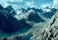
Titcomb Basin
"Camps
must be more than 200 feet from any lake or trail system and 100
feet from any stream in the Bridger Wilderness." 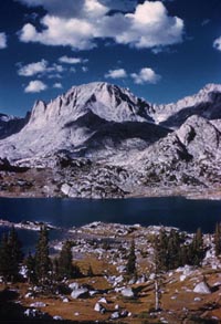
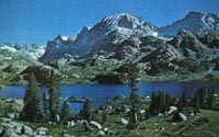
Island Lake & Fremont Peak
East Temple
Fremont Peak
"Motorized
vehicles are prohibited in the Bridger Wilderness, including bicycles,
snowmobiles, carts and chainsaws." 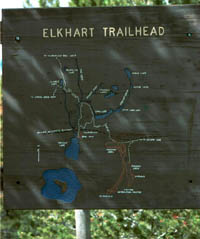
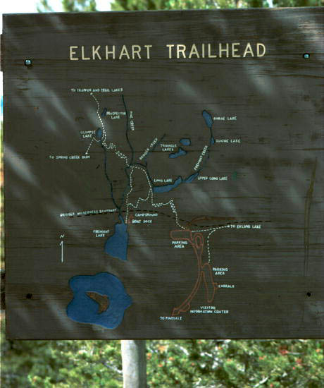
Elkhart Trailhead
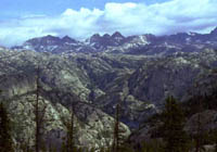
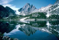
View from Photographer's Point
"Organized
groups such as Scouts, church groups, clubs, school groups must have
a visitor permit, which is free." 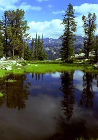
Pond near Photographer's Point
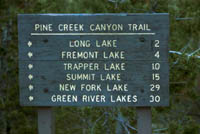
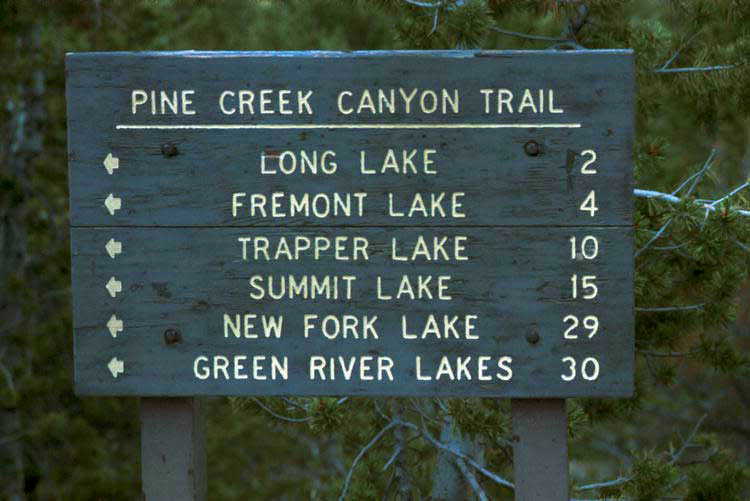
Pine Creek Canyon Trail sign
"Group
size is limited to 15 people and 25 pack and saddle stock." 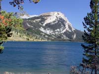
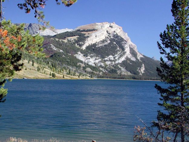
Green River Lake and White Rock Mountain

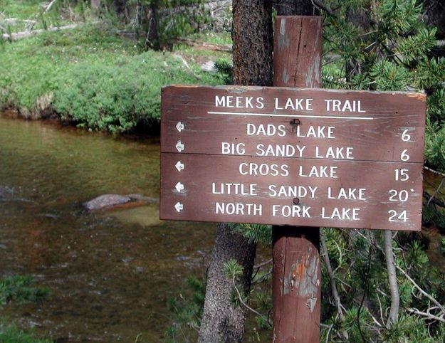
Meeks Lake Trail Sign near Big Sandy
"The
maximum length of stay is 16 days in any one campsite."
Useful
Local Links:
Outdoor
& Sporting Goods
Outfitters & Guides
Lodging
Bridger-Teton
National Forest |